Project coordination
Give owners, contractors, and site contacts a shared visual reference for planning conversations.


Utility mapping
Utility mapping organizes located utility information into a visual reference that can support project coordination, maintenance planning, and future site conversations.
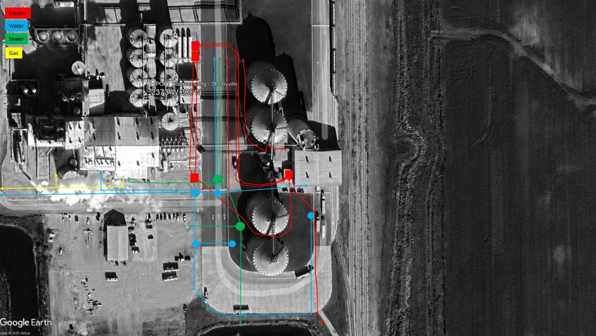 View full-size map
 A visual reference
A mapping reference helps project teams retain the context of located utility information after the site visit. It can support coordination during planned work and provide a starting point for later maintenance conversations.
Project-specific detail and documentation depend on the site, investigation, and service requested.
Where mapping helps
Give owners, contractors, and site contacts a shared visual reference for planning conversations.
Retain useful context for later work in areas with known private utility infrastructure.
Organize located information across properties where several buildings or operational areas are involved.
Keep the information useful
Tell us about the property, the project team, and how the information will be used.